
Plan de Corones > Pracken > Malga Oberegger > Casola

Bruneck and surroundings
Add to favourites
Difficulty
Intermediate
Duration
3:30
in hours
Distance
8.3
in km
Status
closed

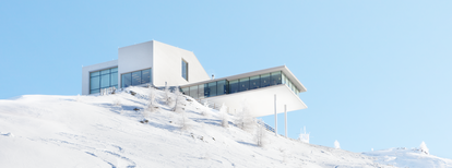
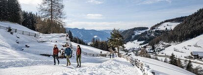
A downhill hike along the eastern face of Mount Kronplatz – with plenty of extraordinary, all-round panoramic views.

Route data
Intermediate
Distance
8,3 km
Duration
3 h 30 min
Ascent
0 m
Decent
1.119 m
Technical skills
Physical condition
Scenary
Highest point
2.275 m
Lowest point
1.156 m
Directions

Take the cable car to the top of Mount Kronplatz from Casola-Gassl near Valdaora-Olang and start your hike on the peak: Follow trail no. 3, then change onto trail no. 2, then take 5B and finally 3 three again. A treeless path across meadows and fields on the eastern slopes of Mount Kronplatz will take you downhill all the way to the edge of the forest. There, follow the signs to Lake Pracken, a water reservoir of the local skiing resort, and hike around it. Continue downhill along the forestry road until you get to Malga Oberegger-Obereggeralm, a quaint mountain inn with a lovely, sun-spoilt terrace. From the inn, hike back to Casola-Gassl.

How to get there

The cable car valley station in Casola-Gassl can easily be reached by car or bus from Valdaora-Olang.

You might be interested in
Discover related tours
Bruneck and surroundings
Hiking Trail AVS
Distance 6,1 km
Duration 3 h 30 min
Ascent 1.314 m
Decent 0 m
Status
closed
Bruneck and surroundings
Four Churches Trail - variant bus stop Hofern
Distance 8,5 km
Duration 2 h 24 min
Ascent 233 m
Decent 200 m
Bruneck and surroundings
Marmot walk
Distance 6,4 km
Duration 2 h 20 min
Ascent 872 m
Decent 35 m
Status
closed
Bruneck and surroundings
Hike to the Plattner alp hut
Distance 3,0 km
Duration 1 h 00 min
Ascent 337 m
Decent 0 m
Status
closed
Bruneck and surroundings
St. Lorenzen/San Lorenzo – Maria Saalen/Maria Sares
Distance 4,9 km
Duration 1 h 00 min
Ascent 170 m
Decent 170 m
Bruneck and surroundings
Lanebach
Distance 3,6 km
Duration 2 h 05 min
Ascent 662 m
Decent 0 m