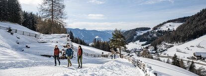

Snow shoes walking at the Sambock

Bruneck and surroundings
Add to favourites
Category
Difficulty
Intermediate
Duration
4:00
in hours
Distance
4.3
in km
Status
closed
WSEN
Suggested period
Jan
Feb
Mar
Apr
May
Jun
Jul
Aug
Sep
Oct
Nov
Dec

Superb hiking options along the ample ridge leading up to Monte Sommo-Sambock and a singular 360° view down onto Brunico-Bruneck, the Dolomites and the Zillertal Alps.

Route data
Intermediate
Distance
4,3 km
Duration
4 h 00 min
Ascent
887 m
Decent
887 m
Physical condition
Scenary
Highest point
2.396 m
Lowest point
1.600 m
Directions

From the Tierstallerhof farmstead, head north along trail no. 66a following the signs to Monte Sommo-Sambock. Cross the meadows to where the woods begin on the right. Take the forestry road until you reach the first left-turn hairpin bend, then continue along the old cart path. Later, head east on the forestry road until you reach the Stockpfarrer meadows. There, keep left crossing the meadows and a small patch of forest followed by more pastures. Hike past the two huts and keep right towards the edge of the forest. Continue straight ahead, first through the thick woods and then through the lighter Swiss pine woodlands until you get to a steep slope. Please note: This 200 m slope leads onto Monte Plat-Auf der Platten, a secondary peak of Monte Sommo-Sambock, and is the most difficult part of the hike. It can be slightly tricky if there is a lot of fresh snow, so please be extra careful!
From Monte Plat-Auf der Platten, hike along the ample ridge and up another two short slopes to get to the peak. Return along the same route.

How to get there

Drive from Brunico-Bruneck or Chienes-Kiens to Falzes-Pfalzen and on to the hamlet Plata-Platten (approx. 1600 m above sea-level). Park your car at the Tierstallerhof.

You might be interested in
Discover related tours
Snowshoeing | © W - Snowshoeing (© TVB Kronplatz - Photo Helmuth Rier) 20120221_4059_Sennes-Senes.jpg (1552 KB, 21, Kiens
Intermediate
Add to favourites
Bruneck and surroundings
Snow shoe hiking tour at the Putzenhöe
Distance 11,3 km
Duration 5 h 30 min
Ascent 980 m
Decent 980 m
Status
closed
Bruneck and surroundings
Snowshoeing on Cima Lasta/Astjoch
Distance 10,2 km
Duration 4 h 00 min
Ascent 713 m
Decent 713 m
Snow shoe hiking tour | © Tourismusverin Kiens, Kiens
Intermediate
Add to favourites
Bruneck and surroundings
Snow shoe hiking tour to the Plattner Spitze
Distance 5,7 km
Duration 4 h 30 min
Ascent 839 m
Decent 839 m
Status
closed
Bruneck and surroundings
Snow shoe hiking tour to the Bel Colle/Schönbichl
Distance 4,9 km
Duration 3 h 30 min
Ascent 967 m
Decent 1 m
Ast Joch | © Raw Media, Kiens
Intermediate
Add to favourites
Bruneck and surroundings
Snow shoes walking at the Cima Lasta
Distance 10,5 km
Duration 3 h 07 min
Ascent 698 m
Decent 697 m
Status
closed