Top

Hike to the Plattner alp hut

Bruneck and surroundings
Add to favourites
Category
Difficulty
Intermediate
Duration
1:55
in hours
Distance
6
in km
Suggested period
Jan
Feb
Mar
Apr
May
Jun
Jul
Aug
Sep
Oct
Nov
Dec
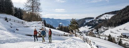
Pleasant family hike from the mountain hamlet of Platten/Plata (1,600 m) to the alpine pasture Plattner Alm/Malga Plata, which invites you to linger and enjoy the panoramic view of the surrounding Dolomites.
Route data
Intermediate
Distance
6,0 km
Duration
1 h 55 min
Ascent
351 m
Decent
351 m
Physical condition
Scenary
Highest point
1.938 m
Lowest point
1.600 m
Directions
From the car park in Platten, follow the meadow path and shortly afterwards you will reach the wide, slightly ascending forest path (marked 67), which leads through a shady larch forest to the rustic Plattner Alm, at 1942 m altitude. Along the way, the forest repeatedly provides a beautiful view of Pfalzen and the surrounding peaks. The easy tour does not require any special equipment, but it is not suitable for strollers or push chairs.
How to get there
With the car from Brunico to Falzes and to the small hamlet Platten/Plata (1600 m).
Alternative: Take the bus 421 or 422 from the Mobility Center in Brunico to Pfalzen/Falzes (stop Rathaus/Municipio); from here walk on path no. 18 and 19 to the Platten/Plata.
You might be interested in
Discover related tours
Bruneck and surroundings
Hiking Trail Concordia 360°
Distance 2,2 km
Duration 37 min
Ascent 58 m
Decent 58 m
Bruneck and surroundings
Gaisinger "Waalweg"
Distance 5,3 km
Duration 2 h 00 min
Ascent 140 m
Decent 140 m
Bruneck and surroundings
Panoramic path Concordia 360°
Distance 2,4 km
Duration 40 min
Ascent 75 m
Decent 75 m
Status
closed
Plan de Corones > Passo Furcia
Distance 3,3 km
Duration 1 h 30 min
Ascent 5 m
Decent 529 m
Status
closed
Bruneck and surroundings
Family hike through the "LandArt" trail
Distance 2,3 km
Duration 37 min
Ascent 36 m
Decent 49 m
Lanebach | © Bruneck Kronplatz Tourismus, Bruneck Kronplatz Tourismus
Intermediate
Add to favourites
Bruneck and surroundings
Lanebach
Distance 3,6 km
Duration 2 h 05 min
Ascent 662 m
Decent 0 m
Status
closed